

 The Inner Stockholm Archipelago in July 2010The Inner Stockholm Archipelago in July 2010
Our Kayak was still at our friend's place in Herrviksnðs. The original plan was to just put it into our car and drive it back home to Stockholm. But already during this so enjoyable trip did we decide to leave the boat at our friends place - later we would paddle it all the way in to Stockholm.
|
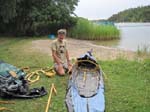
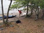
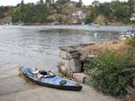
This "later" had now arrived. We managed to get all our stuff into two big sacks and get back to Herrviksnðs by bus. As before, we carried the kayak down to the same beach, put it together there, and had lunch. And off we went!
|
|
|
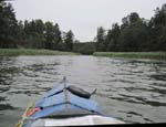
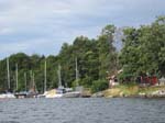
The wind was Easterly, which was good news for us - as soon as we had gotten out of the headwind in the Herrviksnðs inlet. It was nice to mostly paddle/drift in Westerly direction. We soon got into the Kolstr—m area, which is a long and narrow passage to the Baggensfjðrden open water area. On the left we had the large Ingar— island and on the right the even larger Vðrmd—.
This section is often quite narrow, heavily wooded on both sides and ringed with reed. We were often the only boat in site and it felt almost like a fairy tale ride. And when there were other boats, they could not be too big because of the shallowness of the water at places. Alright with us!
|
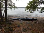
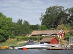
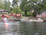
Beaching at Baggensfjðrden |
|
|
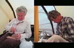
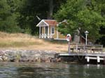
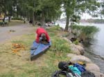
Breakfast preparations |
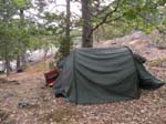
We arrived at Baggensfjðrden (fjðrd is an open water area within the Archipelago) after just over two hours of paddling. It seemed like a breeze and I was surprised that we should already have covered about half of the distance into Stockholm. We landed and unloaded the kayak. Because of the slope of the hill and the multitude of rocks it was difficult to find a good place for the tent. We finally squeezed it next to a big fur tree. It wasn't perfect but we figured we'd be able to sleep there.
|
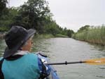
The sun was gone and the wind was up the next morning. When I had checked the weather forecast two days earlier, I had seen mostly sunny skies and fairly light Northeasterly winds. But the rustling of the wind in the branches announced a change. We crossed Baggensfjðrden in 8-10 knot Norththortheasterly wind, with stronger gusts. With no wind drift we would have crossed with the wind on the beam (sideways). However, our boat has no keel, so in order to stay on course I had to counterbalance the drift by steering partly upwind. The arms could feel the onslaught of the heavy gusts! The crossing was a little under 2 nautical miles.
|
|
|
|
|
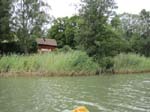
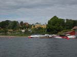
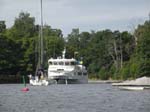
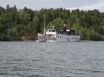
At the end of the fjðrd we made a sharp turn and could then enjoy a long stretch with tail wind. We had entered another narrow passage on the way in to Stockholm, Baggensstðket. Unlike Kolstr—m it was ringed with homes instead of reed. It was also quite a bit deeper so big boats could pass and it is in fact one of only two waterways from Stockholm out to the Baltic. As you paddle along, you will have the Mainland on your left and still the large Vðrmd— on your right.
The narrowest section is at the end. As we were about to enter, the honking announced the arrival of a large passenger boat. Fortunately we did not meet it at the narrowest portion!
|
|
|
Another sharp turn, now due West Bound, led to the Lðnnersta Sound. By keeping on the Windward side of the sound we could stay out of most of the wind.
|
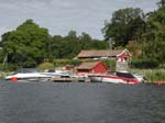
Yet another sharp turn led us Northwards again - and again almost straight into the wind! Ahead of us was the long Skurusund, which we hugged on our right to try to stay out of the wind as much as possible. A little further ahead we found a boat slip. Since it seemed to be unused for the moment, we parked there and had lunch and a break. Meanwhile, we could watch all the marine traffic channeled via the South entrance to Stockholm.
North again with varying wind strength. As we started to get close to the end of the sound, it widened. The turn into the city lay at the other, left, side of the sound. We had to cross and then beat the last part against the wind and the waves as much as we could. We learned later that the wind had been at a steady 12 knots with gusts up to 24. We could certainly feel it!
There was a lot of of boat traffic in the main Stockholm channel. As we turned into it, we kept close to shore to avoid any unnecessary paddling against the wind. The waves from commercial ships and power boats of all sizes bounced against the rocks, creating standing waves (clapotis). Well, we were on a very stable kayak so there was nothing to worry about.
|
Waldemars- udde |
|
Skepps- holmen |
|
|
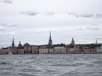
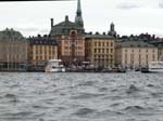
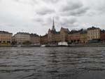
Gamla Stan |
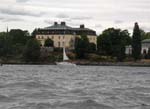
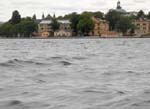
After the sharp left turn we had a strong tail wind instead, so we made good headway. Thus it was easy to enjoy the beautiful sites as we entered into the city - The Museum of Prince Eugen at Waldemarsudde, the island Skeppsholmen with among other things The Museum of Modern Art, and Gamla Stan, the medieval old town.
|
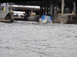
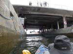
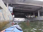
Entering the Locks |
|
|
Into Mðlaren |
However, we do not live at the - somewhat only - salty waters of the very well protected Baltic Sea, we live on Lake Mðlaren. The two are connected by several locks, the smallest of which is right at Gamla Stan and to which we proceeded. There was lots of boat traffic there and we bounced around quite a bit. The locks themselves were calm and almost empty - it was Saturday and people headed out of town, not into it.
|
Gamla Stan |
|
At home! |
What a difference on the other side, a difference that you do not perceive when you walk around town! The waters were calm with hardly any waves. It did not take us long to reach our destination, right below our apartment. A small drizzle had developed so it was time to get out of the kayak anyway.
Later I realized that the camp at Baggensfjðrden was not well chosen - it was not half the way to Stockholm, only one third!
July 23: Herrviksnðs -> Baggensfjðrden 6.0 July 24: Baggensfjðrden -> Stockholm 12.3Total: 18.3 nautical miles (33.9 km; 21.1 statute miles)
=================================================================
Robert af Sandeberg