Show chart of the Bunaken Islands
It was already getting late when we finally pull out of the sandy harbor.
The clouds were clearing away, and the water was almost like a mirror, surprisingly
calm considering the distance to the next islands.
It was an undescribable feeling to finaly slice through the water. We had had so much
hassle getting here (but then again, of course, nobody would expect it to be easy
to bring your own kayak to Indonesia!): first all the email and phone conversation
with Singapore Airlines - partly passing through freight companies - to try to avoid
paying for overweight; and after a month or so, they agreed to let us bring 30 kg on
board the aircraft rather than the normal 20; second to take our 70+ kg on two trains
to the NOT handicapped-friendly Paris airport, far away from our home town;
third noting that this wonderful airline did not even weigh our three heavy
sacks; fourth finding out on arrival in Manado that the ferry to our original
destination was cancelled - we had gotten the ferry schedule over the phone to Indonesia
and then booked our airline ticket accordingly; and finally fifth trying to by
all the food in Manado, which was sadly lacking of what we wanted (of weight conserns
we had brought hardly any food from France).
We only paddled half an hour that first evening. Night was falling with the speed of
the tropics. Moreover, an Indonesian on the ferry had talked us into spending
the first night at his hotel, which was tucked away at the beach and almost
hidden in the dense forest. So we landed there and let them cater for us.
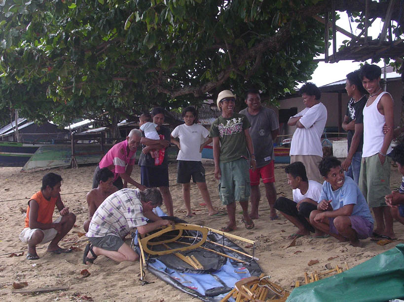
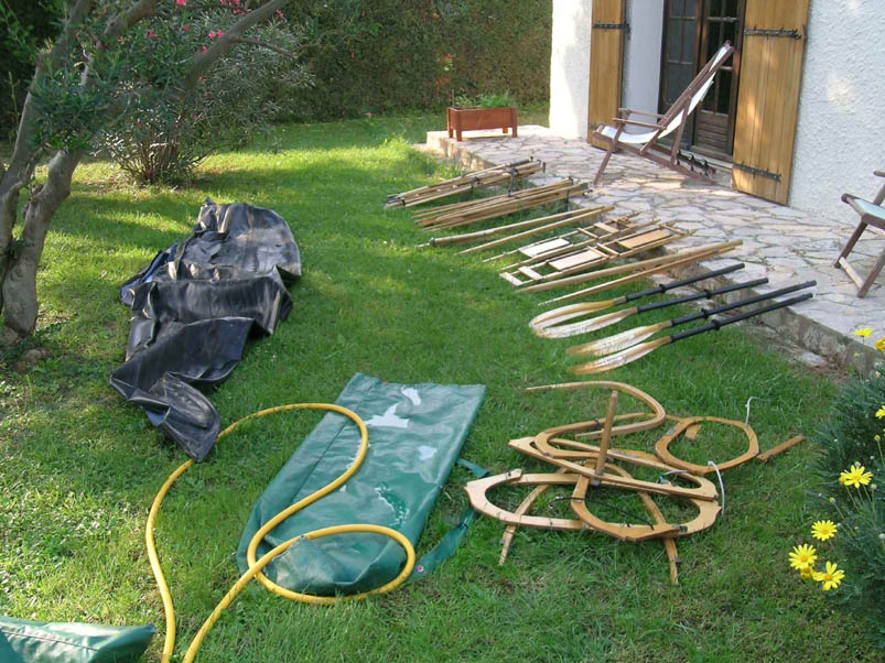
The next morning we finished putting the kayak together - the non-essential parts, which
we hadn't had time to finish yesterday. And then we headed out
 towards ... well,
we didn't exactly have a chart. The chart we had brought was from Biak in Papua New Guinea,
a long way from here. The only map over Bunaken that we had was from our
Footprint Indonesia Guidebook, and it had to do. And it did.
towards ... well,
we didn't exactly have a chart. The chart we had brought was from Biak in Papua New Guinea,
a long way from here. The only map over Bunaken that we had was from our
Footprint Indonesia Guidebook, and it had to do. And it did.
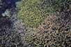
A little bit away from the beach we found the first corals, and I quickly slipped
into the water. They were nice, yes, but nothing like the Banggai Islands or what I had
seen in Fiji. And they seemed a bit far out to swim to from the hotel.
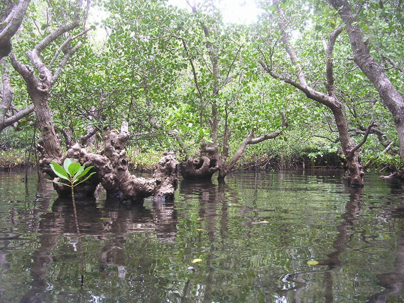
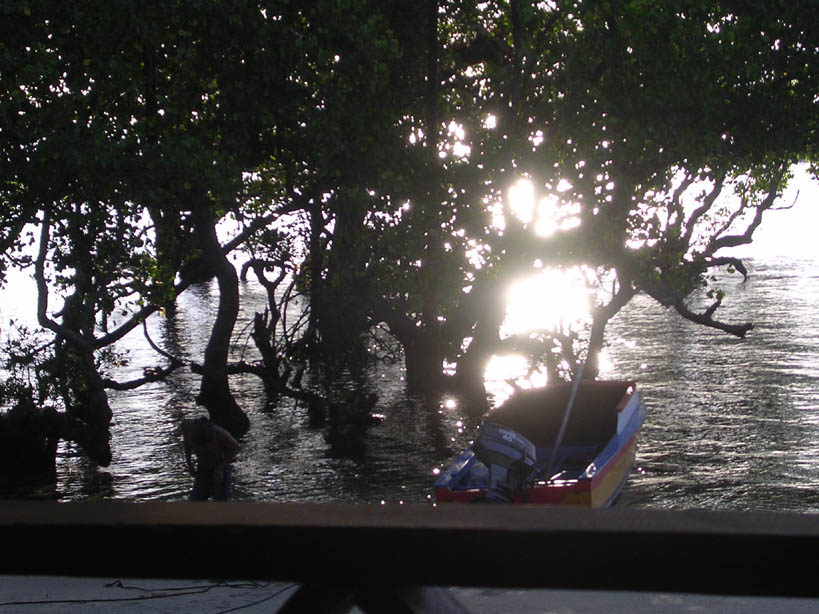
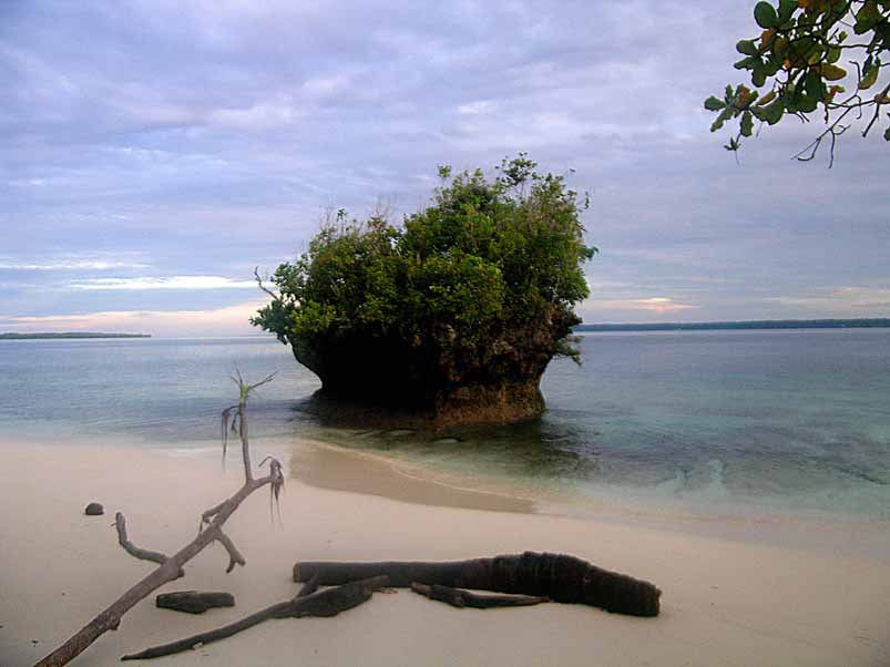
It did not take us long to meet the first mangrove trees, standing far out in
the water with their air roots. We would discover that the Bunaken island
was surrounded by them, and that it in fact had very few beaches. It is a very
flat island. As we followed along the shore, there was an opening between the mangroves
 big enough for our kayak, so we slipped into a large swampy area.
What a wonderland that opened up inside! That was something that I had never before been among.
big enough for our kayak, so we slipped into a large swampy area.
What a wonderland that opened up inside! That was something that I had never before been among.
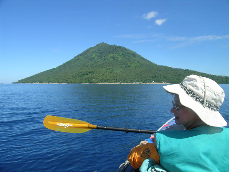
Around a point and Manada Tua (Old Manado), a volcanic island, appeared in front of us. It was a 2 nautical
miles open water crossing to get there, but the sea was almost like glass and it was a breeze
to get over to the other side. This island was totally different, obviously volcanic,
with no mangroves but lots of beaches instead. Certainly more inviting for a
kayaker! There were no other non-Indonesians here. This was partly because we were
still at the end of the rainy season - later this year than normal - and that
most westerners come to Bunaken to enjoy the underwater life, since it is a
Marine National Park. The tourists that do come to Manado Tua are divers, and they
stay in - and under! - boats offshore.
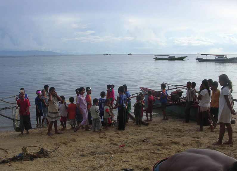
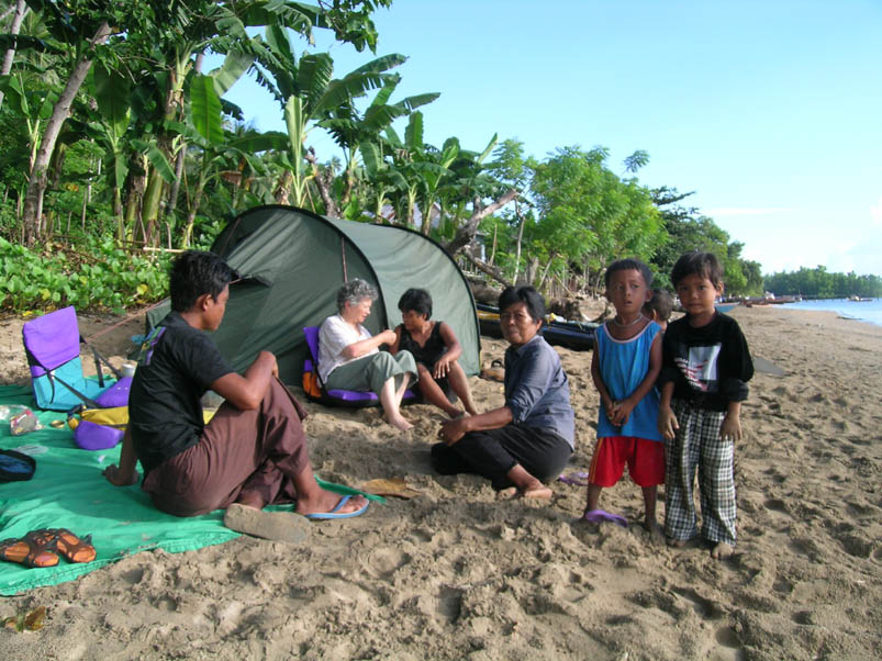
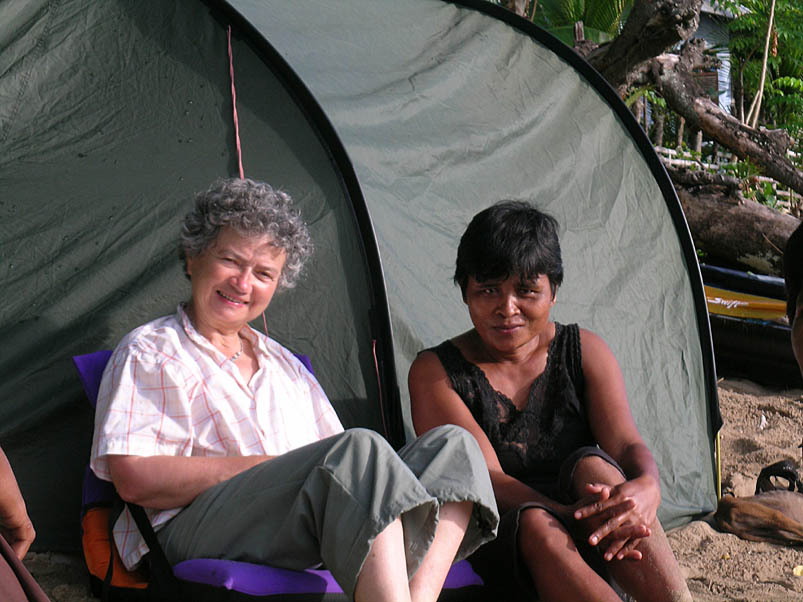
But we headed straight for the beach at the edge of a village. It did not take
very long for curious children and adults to come and greet us as we started
unloading our gear and putting up the tent. We were obviously not very common visitors,
and needed to be checked out. All these staring and friendly eyes certainly reminded me of my
previous kayaking expedition to Indonesia, even though we were not as far from the beaten track
this time.
Still jet lagged, so we had an early dinner. Almost all the food came from the
stores in Manado - sorely lacking of what we had hoped for. Of weight concerns we
had packed almost no food from France. Some Indonesians remained around us and made us a fire,
but we turned in at 8 PM already and slep well until midnight. We could hear voices
outside - probably fishermen.
It was raining in the morning. This was supposed to be the end of the rainy season,
however, nobody had told the weather about it! But what did it matter - it was so warm anyway.
When the rain eased off, we went out to see our newfound neighbours again.
Good spice mixture for breakfast, that we had bought the other day. We tried to ask a woman what they were,
but I don't think that she was too impressed by my command of Bahasa Indonesia
(bahasa = language), so we did not get too far.
All these children with their innocent eyes, who like to play soccer, swim, play in the sand,
fish - or look at us. A life so incredibly less complicated than our own.
They have no TV, video, computer, vehicle. They are not rich in our standards,
but do not lack in food, clothing, schooling, etc. And without doubt they are much
happier than the childre where we live.
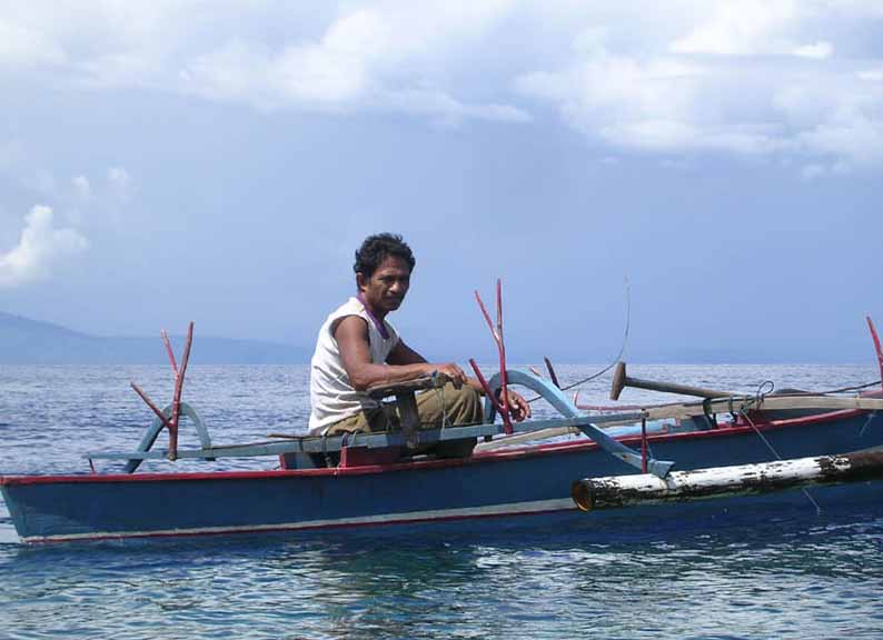
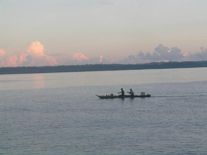
We launched the kayak at 9:30 to paddle around the island clock-wise. There were lots of
fishing villages and fishing boats along our way in in the beginning. Several people had told us about
currents here and, unfortunately, we soon found ourselves fighting them.
We passed the southern point, where I estimated the current to be around one knot.
On the west and north end of the island, the villages became more and more sparse
and it was almost inhabited.
The dormant 820 meter volcanic peak on Manado Tua can be seen for miles around.
In fact, this was the big landmark that we had seen from the airplane just before landing.
Much later, I found this information for divers: "Current is often stronger and
visitors often larger, big barracuda, trevally and sharks."
There have even been sightings of spermwhales (the infamous Moby Dick by Herman Melville).
We knew nothing of this at the time - we did not even know that we were
going here! - and saw none of these bigger fish when we followed the corals
close to shore.
We stopped for a bite to eat and to rest near the west end. From here no other land
could be seen, just the big, blue ocean (the Celebes Sea to be more exact).
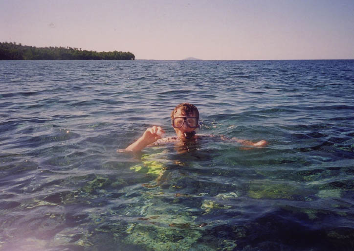
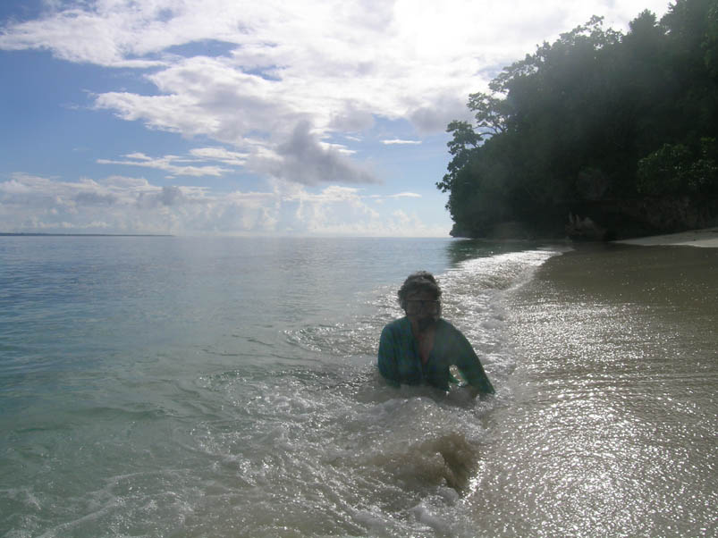
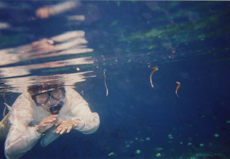
We also went snorkeling, the first time in her life that Ghislaine had tried this with mask and
fins. It went like a charm, which gave us both an immense pleasure. Maybe mostly for her,
of course, but for me, too.
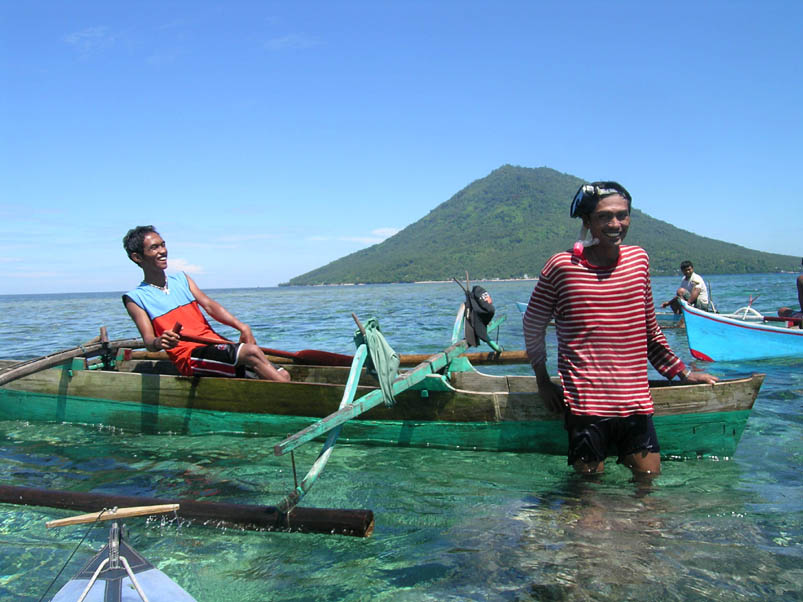
A few indonesians came up to look at our kayak. Most likely this was the first time in their
life thay they saw a craft like this. I had seen the same curiousity ten years ago. Their paddles
are more like canoe paddles, so they will move them between the left and right hand side
all the time.
Further north the current turned and now flowed with us instead. It picked up some
strenght and seemed to be around two knots at the norternmost point. The paddle seemed longer
than expected, and we were glad to finally spot our tent again - quite tired.
A teacher, Emma, came up to us. She spoke fair English, so we had our first real
converation on the island. A little latere Sandli came with fresh bananas grown locally.
They tasted heavenly compared to the plastic wrapped cousins the were offered
in the stores of Manado despite the tropical climate.
The sky darkened and the wind picked up. The locals fled away and the heavy rain
did not take long to descend on us.
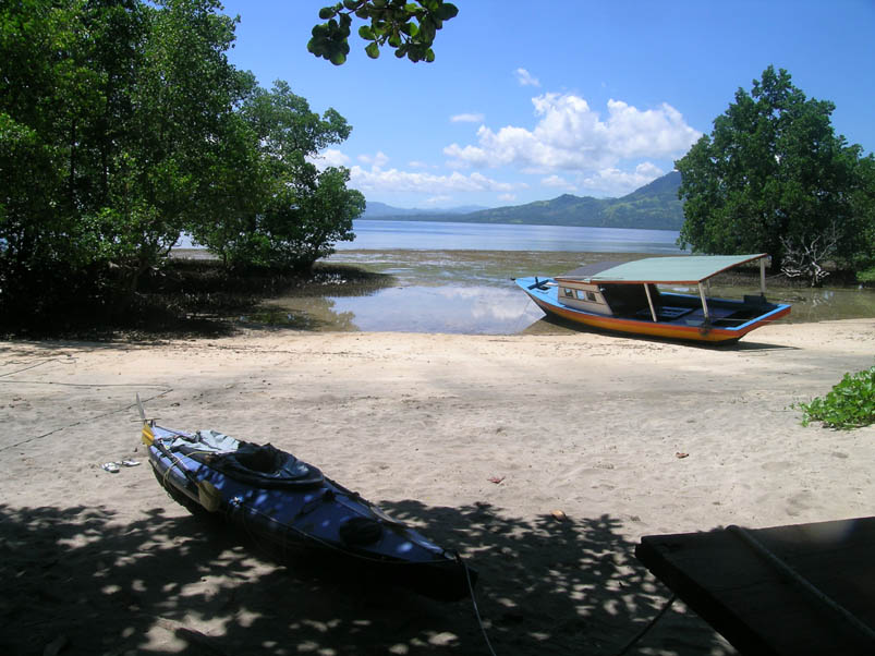
The next morning we crossed back to Bunaken Island and then followed it along the north shore.
The east side was thick of mangroves. The only beaches were part of tourist
lodges and there was no other place to park a kayak. So we chose one of the last ones
on the eastern side, not too far from the ferry landing on the
southern side. This turned out to be a wonderful spot and we spent
three nights here.
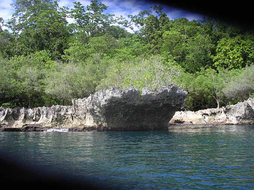
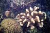
There was a reason that we wanted to see this part of the island. According
to our Footprint Indonesia Guidebook the corals should be especially good at
the east side of Bunaken island. So we first swam out and, later, took the kayak out,
since they were far out from the beach.
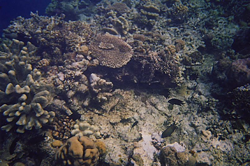
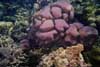
We were not disappointed. They were very reminiscent of the wonderful corals
that I had seen in the Banggai Islands ten years ago. First it was shallow and fairly
level, and then a big dropoff, with beautiful corals everywhere. I could see why divers loved
this place. And Ghislaine could easily understand and join me in my love of
snorkeling!
Bunaken Summary
Paddling distances in nautical miles
May 10: Bunaken -> Bunaken Hotel     1.2
May 11: Bunaken Hotel -> Manado Tua  4.1
May 12: Around Manado Tua            6.9
May 13: Manado Tua -> East Bunaken   5.7
May 14: East Bunaken                   -
May 15: East Bunaken                   - + 1
May 16: East Bunaken -> Harbor       0.7
Total: 18.6 + 1 nautical miles (34.4+1.9 km; 21.4+1.1 statute miles)
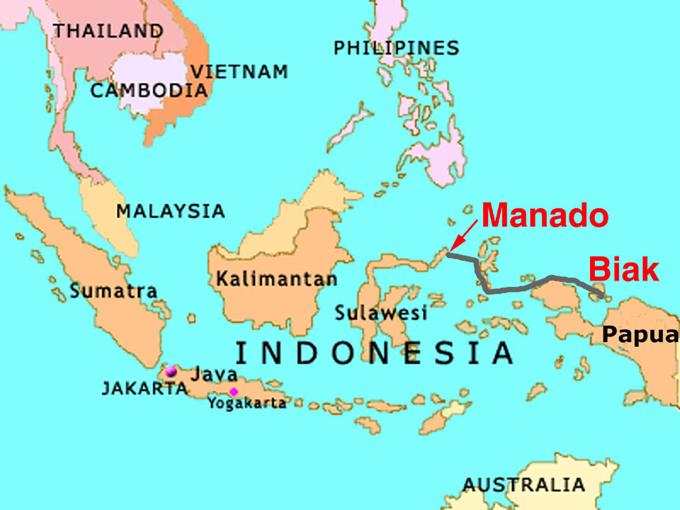
2. The Ferry from Manado to Biak
We were back in Manado in time for the ferry, the one leaving one week later than
the one orginally planned. It was a big ship and we did manage to get on, with
the help of a porter to plunge through the immense crowd of people, and we did
manage to secure a first class cabin. Not that we needed first class, but this
was the only way for us to lock out kayak and belongings in a secure place.
That was the end of the similarities with the ferry from 1997. In fact, this
ferry just came from Banggai Islands, but it was full to crack with people. Then,
in 1997, it had felt like a cruise with the upper deck all to ourselves. Now, in
2007, there were people sleeping just outside our first class cabin and we could
not see out the windos because of the big boxes piled in front of it. There were
just two places, it seemed, where nobody was sleeping: in the toilets and the
restaurant (which was nothing like the one ten years ago).
But, almost two days later, we finally emerged at Biak in Papua; this is the
Indonesian part of New Guinea, formerly called Irian Jaya.
3. Paddling around Auki Island
Show chart of the Auki islands
We had traveled to Indonesia to celebrate my 60th anniversery on one of the many
wonderful coral reefed islands. This was my desire, just like I celebrated my 50th
anniversery here.
But the ferry cancellation had changed everything.
On my birthday we found ourselves on a very crowded ferry that dropped us
off at Biak in the afternoon. There was just no way that we could
get the kayak and supplies ready to paddle out to an island for a proper celebration.
But two days later, with a cold and a head-ache mostly out of the way,
we were ready to hit the waters again. Never mind the thunderstorm during the night
and the rain in the morning. When Victor, our excellent taxi driver, dropped us off
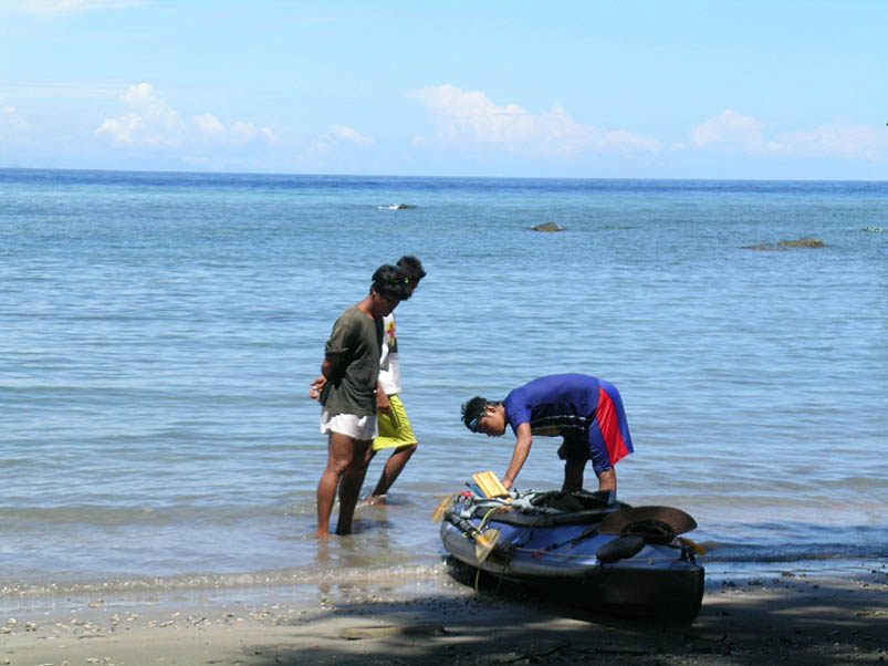
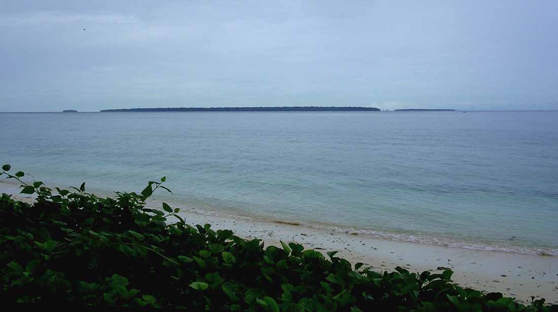
at a beach near Bosnik, the rain was almost gone.
Victor stayed with us and helped putting the kayak together. After a while some
children and adults showed up. Getting the boat in order was much easier this time,
despite a few mistakes and the wood beeing a bit swollen. It took "only" 1 hour and 40 minutes.
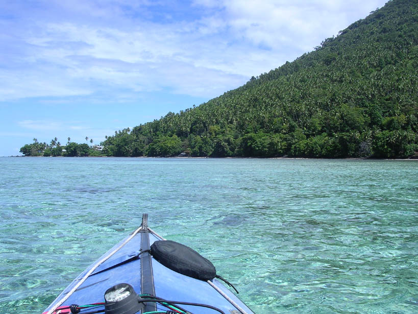
We set the course to the West point of Pulau Auki.
Between Auki (the big island in the middle on the picture above)
and Mios Worki, the small island on the right hand side,
there was a narrow opening. By comparing this opening to the chart,
it was easy to determine exactly where our little beach was located -
and from where we had started.
Thus the crossing distance as the crow flies should be 5.9 nautical miles.
When I had estimated it looking at the chart earlier, in the comfort of our home,
I came up with 4.4 nautical miles - the shortest crossing between Biak and Auki.
My plan had obviously been to cross right there.
But how to convey this to an Indonesian
taxi driver that speaks absolutely no English? My own command of Bahasa Indonesia
was never very good, but it was certainly even less so now than ten years ago.
I was glad that it had served to bring us this far!
A little offshore it soon became apparent that there was a current, pushing us
eastwards towards the Pacific Ocean. The narrow opening between the two islands became
even narrower and eventurally disappeared. To get us back in course and to try to stay
in course, I started ferrying (steering at an angle) 20-30%. That would indicate a
current speed of some 1.5 knots.
Judging from the crossing speed, the fact that ferrying looses some speed,
and the lay of the land on the chart, I
am also convinced that the current was not straight from the side but also
slightly in our favor.
As during the first trip to Indonesia, we had no way of finding out
weather and current forecast. We tried to guess the weather by looking at the sky,
and the wind and current ... well, we found out as we paddled.
Closer to the other side we started getting tired. Then a school of dolphins cheered us up,
jumping and enjoying themselves. I was especially pleased, since this was the first
time that Ghislaine had seen dolpings. And then, finally, after 1h 50m of paddling, we arrived at
the other end. We continued along the short side of the island. My idea was to
find a nice, protected beach around the corner among all the corals.
Well, it was low tide and we saw the corals just all too well here and on the
backside of Auki. Not even a kayak could pass!
So turned around to the exposed side - but there was little wind and the swells were
fairly small. The island, though, looked very inhospitable. Few and small beaches
that most likely would disappear at high tide. At the same time, it was
strangely beautiful with strange limestone formations. Good for the eye but not for landing!
But there was one beach, though, that was just slightly larger. We did not dare to pitch
the tent on the sand, not knowing how high the tide would rise. There was a sort of a
clearing in the dense forest. Water on the ground! I tasted it and was glad to notice
that it was sweet and not salt. Also, no mangrove but a few coconut trees
- that don't seem to like salt water - and a few flowers
convinced us that it was above high tide. There were also lots of branches,
that had not floated away. Another good sign! Not a great camp site, but it
had to do. We cleared away the branches and pitched the tent.
Then we benefited from low tide by making dinner on a few flat rocks near the water.
More dolphins came and greated us and the sunset was magnificient.
Broke camp the next morning. Fortunately, the tide hadn't reached as high as I had
feared. But the tent place in the forest wasn't worth a second night.
Where to go? I let the current decide, which meant following it eastwards.
The island still looked very inhospitable, though we passed what looked more
like a real beach. At the end of the island I steered the kayak south.
We passed a little point and beyond that, at the southeast end of Auki,
there was a beautiful beach, ringed with coconut trees.
|
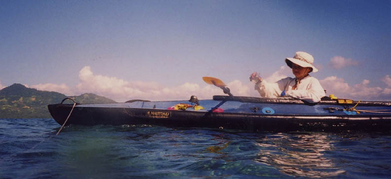
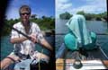
The kayaking team
|
Just exactly what a kayaker dreams about - but there was a catch.
The gentle swells had started building and building as the Pacific Ocean
came nearer. I was surprised by the fairly rapid changed, but later
realized that it was much shallower here.
The waves towered and then crashed onto the beach with cascades of foam everywhere.
I let the kayak drift while studying the waves for a while. Was there an
opening where we could slip in? I did not see any. We should be able to land
anyway, but it would not be easy and Ghislaine, being a novice kayaker, probably
wouldn't like it.
Instead we found a small beach - or rather a flat rock - a little protected by the point, so I
headed there. Just as I turned the boat, a big wave surprised me, starting to break
and hitting the kayak on the beam. Oh well, the Nautiraid is very stable and
there was no danger, but I should not be caught in such a situation.
After lunch and a break we explored the area and the weird small stack islands, before heading
back to the promising beach we had seen in the morning. The dolpins came quite near
- this was the fourth time that we saw them. We pitched the tent on
the beach this time - more pleasant but also amidst all the sand again.
We spread out our thin, green tarp for protection. Unfortunately, my fever came back in the afternoon.
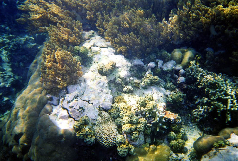
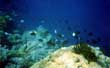
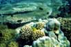
The Underwater Realm
Later we went snorkeling. It was SO easy here - put on the mask and fins and
swim out five meters and you were right among the corals.
They were also very interesting, just about as good as the best that we had seen
in Bunaken.
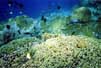
We snorkeled more the next morning, this time a little bit further out. There the corals
were incredible, as good as I had seen anywhere before (Banggai Islands, Fiji, and Bunaken).
There was lots more fish here than in Bunaken.
I felt much better now, but still had not recuperated completely. We took off at 9:30
back to Bosnik, with compass course 310°. Somehow we had managed to hit the tides just right,
since there was no sign of a current (it was half moon, which tends to reduce tides
and currents). Not a breath of air stirred the water surface.
Further out Ghislaine realized that it was only out there, on the ocean, that you found real
silence, because on land you always hear sounds from birds, insects, and other animails.
Just a few minutes later she was corrected by the dolphins, loudly barking!
One of them came very close.
We tired quickly and soon had to struggle, but finally made it across at 11:45.
To simplify finding transportaion back to Biak, we landed smack in the middle of the
village rather than
on the deserted beach that we had taken off from.
Immediately the villagers helped us carry the kayak ashore and up to a tiny lawn.
There was no restaurant in the village, but we found a good rice meal from a small vendor
on the beach. I took the kayak apart - with lots of helpers. A bemo showed up and acceepted
to carry us and all our gear back to Biak - and to the hotel without extra charge!
A service unthinkable of in the West.
We got the same room in our nice hotel. I had neither fever nor headache the following morning,
but it would take me one more full day before I recoved completely.
Auki Summary
Paddling distances in nautical miles
May 22: Biak -> Auki                 6.6
May 23: Along Auki                   6.5
May 24: Auki -> Biak                 5.7
Total: 18.8 nautical miles (34.8 km; 21.6 statute miles)
4. Before and after
=================================================================
Robert af Sandeberg